Data-Driven Marine Engineering
Successful marine projects begin with accurate data. Starhigh provides end-to-end hydrodynamic modelling and hydrographic survey services — from feasibility studies through construction and post-works verification. Our integrated capabilities support dredging, reclamation, port infrastructure, coastal protection, and environmental assessment projects across the region.
Capabilities
2D and 3D Flow Modelling
Simulation of water movement in horizontal and vertical dimensions to understand current behaviour, flow distribution, and interaction with structures.
Tidal and Current Analysis
Analysis of tidal data for creating Chart Datum, as well as producing predicted tide and predicted current to support marine operations and engineering design.
Sediment Transport and Morphological Assessment
Evaluation of sediment movement and seabed changes over time to identify erosion, deposition, and long-term morphological evolution.
Dredging Impact Studies
Assessment of hydrodynamic and morphological changes due to dredging activities, including their effects on flow patterns and sediment behaviour.
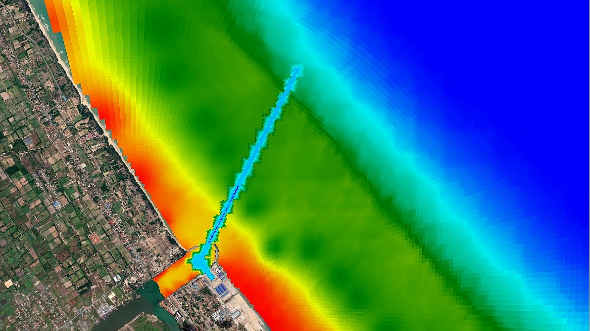
Coastal and Port Hydrodynamics
Investigation of water dynamics in coastal and port areas, including wave-current interaction and circulation patterns.
Singlebeam and Multibeam Hydrographic Surveys
Acquisition of accurate depth data using echo sounding systems for detailed seabed mapping and underwater profiling.
Pre-, Interim, and Post-Dredging Surveys
Monitoring of seabed conditions before, during, and after dredging, including volume calculation for progress tracking and verification.
Bathymetric Mapping and Seabed Profiling
Generation of high-resolution maps and profiles of the seabed to support engineering, navigation, and environmental studies.
Positioning Using GNSS and RTK Systems
Application of precise positioning technologies, including the creation of temporary benchmarks for accurate spatial control.
Chart Production
Preparation of hydrographic charts in accordance with IHO standards for reliable reporting, navigation, and decision-making.
Need precise marine data?
Our hydrographic team is ready to support your project from feasibility to delivery.